
When I first tried OsmAnd a few years ago it was overwhelming, there is so much to customize.
I tried it again recently and it really impresses me.
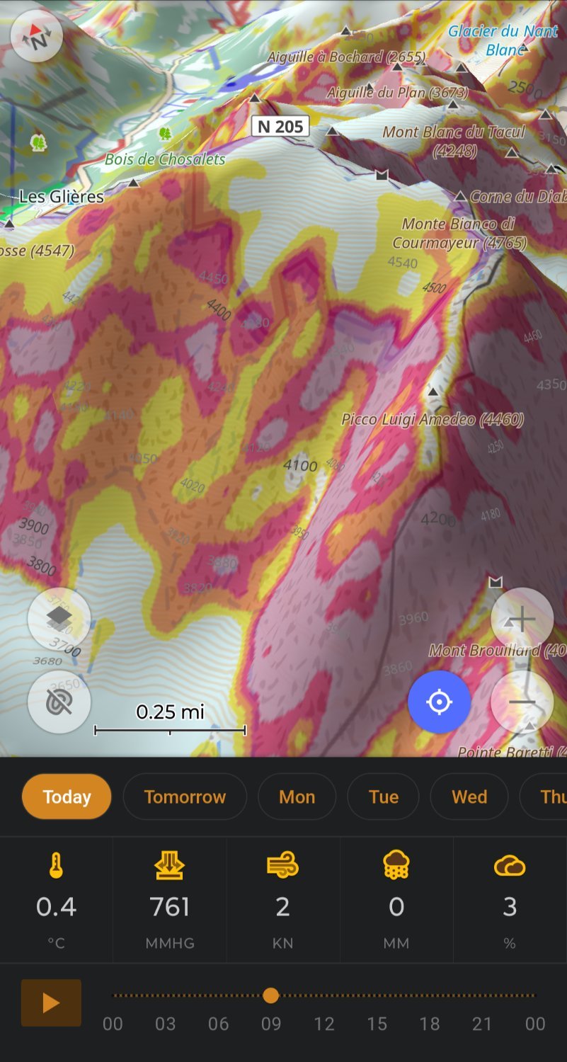
My OsmAnd ski profile shows me slope for avalanche risk and 3D relief so I don’t need Fatmap, plus OsmAnd let’s you download 7days of weather.
OsmAnd doing routing on hiking trails replaces my need for Gaia.
Really impressive work by the OsmAnd team.
You must log in or register to comment.
I used it for the first time last week on a hike. It worked, but not intuitively at all. I had downloaded a GPX file which I imported in Osmand, and before I got the navigation working I had inadvertly added two waypoints.
The nice slick interface of Organic Maps makes me wish it loaded and zoomed smoother. But yeah the things you can do in OSMand as a fully offline app is incredible once it’s set up how you want it.